


Beli gps garmin 64s di monotaro.id
%2C%20Perlindungan%20Diri%20%26%20Kesehatan/Alat%20Keselamatan%20Kerja/Radio/Garmin%20GPSMAP%2065s/haP108476622-1.jpg)
%2C%20Perlindungan%20Diri%20%26%20Kesehatan/Alat%20Keselamatan%20Kerja/Radio/Garmin%20GPS%20Genggam/obP108229875-1.jpg)
/P101518176-1.jpg)
%2C%20Perlindungan%20Diri%20%26%20Kesehatan/Alat%20Keselamatan%20Kerja/Radio/Garmin%20GPS%2073/6zP108582251-1.jpg)
%2C%20Perlindungan%20Diri%20%26%20Kesehatan/Alat%20Keselamatan%20Kerja/Radio/Garmin%20GPS%20Genggam/m4P110055796-1.jpg)
%2C%20Perlindungan%20Diri%20%26%20Kesehatan/Alat%20Keselamatan%20Kerja/Radio/Garmin%20Handheld%2FPortable%20Aviation%20GPS/2dP110454085-1.jpg)
%2C%20Perlindungan%20Diri%20%26%20Kesehatan/Alat%20Keselamatan%20Kerja/Radio/FURUNO%20GPS%20Navigator/22P105711074-1.jpg)
%2C%20Perlindungan%20Diri%20%26%20Kesehatan/Alat%20Keselamatan%20Kerja/Radio/Garmin%20Portable%20ADS-B%20Receiver/2sP110454100-1.jpg)
%2C%20Perlindungan%20Diri%20%26%20Kesehatan/Alat%20Keselamatan%20Kerja/Radio/HAIGO%20GPS%20Chart%20Plotter%20with%20Fish%20Finder/roP105710996-1.jpg)
%2C%20Perlindungan%20Diri%20%26%20Kesehatan/Alat%20Keselamatan%20Kerja/Radio/HAIGO%20GPS%20Navigation/01P105711001-1.jpg)

%2C%20Perlindungan%20Diri%20%26%20Kesehatan/Alat%20Keselamatan%20Kerja/Radio/Garmin%20GPSMAP%20H1/8dP112734301-1.jpg)
%2C%20Perlindungan%20Diri%20%26%20Kesehatan/Alat%20Keselamatan%20Kerja/Radio/FURUNO%20Transducer/49P105711153-1.jpg)
%2C%20Perlindungan%20Diri%20%26%20Kesehatan/Alat%20Keselamatan%20Kerja/Alat%20Pelindung%20Jatuh/Produk%20Terkait%20Sabuk%20Keselamatan/TITAN%20Karmantel/oaP108329874-1.jpg)

Kami Menampilkan Rekomendasi Kami Untuk Anda! Anda Bisa Membelinya Kapan Saja di monotaro.id
 Garmin GPSMAP 65satribut:
- Display Dimensions WxL (cm); Diagonal (cm): 3.6x5.5; 6.6
- Display Resolution (Pixel): 160x240
- Waterproof Rating: IPX7
- Memoryi (GB): 16
- Battery Life (hour): 16
- Default Map: TopoActive; Routable
- Dimensions (mm): 61x160x36
- External Storage (Gb): Up to 32
- Map Segment: 3000
- Rute: 200, 250 Titik Jalur Per Rute; 50 Titik Jalur Perutean Otomatis
- Track Logs: 10.000 Titik Jalur Aktif; 200 Jalur Persimpangan
- Tracks: 200
- Waypoint/Favorit/Location: 5000
- Garmin GPS GenggamDeskripsi:Dengan pemetaan yang dapat dirutekan untuk jalan dan jalan setapak, perangkat genggam Montana 700 menghadirkan fitur luar ruang canggih ke dalam format 5" kokoh yang ideal untuk navigasi dengan berjalan kaki, bersepeda, kayak, ATV, dan banyak lagi.
-
- BOSCH Digital Laser Distance Meter (Meteran Laser)Deskripsi:The Bosch Laser Measure allows users to take distance measurements instantly and with ultimate precision. Simply press the measure button to activate the laser and begin measuring in real time. Put down the pad of paper and calculator
- Garmin GPS 73atribut:
- Display Type: 4 Level Gray LCD
- Screen Size (cm): 1.4x2.1
- Display Resolution (pixels): 128x160
- Battery Type: 2AA
- Waypoints/Favorites/Locations: 1000
- Battery Life (hour): 18
- Navigation Track Log: 10,000 Locations; Save 200 Routes
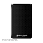
- Transcend Portable Hard Drives StoreJet 25A3Deskripsi:Rugged durability doesn't always come at the expense of style. The StoreJet 25A3 external hard drive offers an impressive level of anti-shock protection without sacrificing its slender good looks. This feature-packed hard drive is equipped with a USB 3.1 Gen 1 interface, a multifunction button, and up to 2TB of storage capacity.atribut:
- Dimensions (mm): 130.6x80.1x15
- USB type: micro USB to USB Type A
- Connection Interface: USB 3.1 Gen 1
- Storage Media: 2.5inch HDD
- Operating Temperature (°C): 5 to 55
- Operating Voltage (V): 5
- Garmin GPS Genggamatribut:
- Waterproof Rating: IPX7
- Display Resolution (Pixel): 240X400
- Memoryi (GB): 16
- Screen Size (cm): 3.8x6.3
- Battery Type: Internal Rechargeable Lithium-Ion
- Compass: YES
- Dimensions (mm): 62x163x35
- GPS: YES
- Image Viewer: YES
- Interface: USB-C
- Map Segments: 15000
- Navigation Tracking Log: 20000 points, 250 saved gpx tracks, 300 saved fit activities
- Screen Type: Transflective Color TFT
- Smart Notifications: YES
- Waypoint/Favorite/Location: 10000
- Weather: YES
- Garmin Handheld/Portable Aviation GPSDeskripsi:Fly confidently with our rugged, reliable, purpose-built GPS that includes our latest in-flight features, including IFR approaches, arrivals and departures, plus our familiar touchscreen interface.atribut:
- Display Type: Touchscreen WVGA Color TFT with White Backlight
- Voltage Range: 10-35
- Display Resolution (pixels): 480x800
- Sbas/Waas/Glonass Receiver: High-Sensitivity with WAAS Position Accuracy
- FURUNO GPS NavigatorDeskripsi:Simple, dependable worldwide communications at an affordable price.1136 channels160 programmable, 242 ITU SSB duplex, 72 ITU SSB simplex and 662 ITU FSK duplex channels are available.Rugged constructionThe highest quality components are used throughout. Constructed in a die-cast aluminum chassis with surface mount components, the IC-M710 is designed for long hours of operation in the harsh marine environment.Alphanumeric readoutThe large, easy-to-read display shoes status at a glance. Seven characters can be programmed into each memory channel to conveniently display station names, ship names, etc.150 W of outputA full 150 W (PEP) of output power is available for reliable long distance communication. A large cooling fan, in combination with the aluminum chassis, allows continuous transmission at full output power—even during demanding RTTY (radio teletype) and NBDP (narrow band direct printing) operation.Automatic tuning functionAn automatic tuning function is available when using the IC-M710 in combination with the optional AT-140 for quick and easy antenna tuning. Tuning is fully automatic. When you push the PTT on a new frequency, the antenna tuner quickly tunes the antenna automatically.Easy to useTwo large memory and frequency dials allow quick and easy operation.And more…Covers all allowed bands between 1.6 and 27.5 MHzGeneral coverage receiverModes: SSB, RTTY, CW and AM2182 kHz alarm built-in (optional for General versions)RF gain controlAudio activated squelchTerminals for frequency/mode control via NMEA interfacingDirect keypad channel selection entryLarge, front-mounted speakerDirect keypad channel selection entryWeather fax readyBacklight controlCW full break-in and semi break-in Highly accurate position fixing GPS navigator with clear color LCDThe FURUNO GPS navigator GP-39 provides accurate and reliable position fixing, thanks to a 12-channel GPS receiver combined with integrated SBAS (WAAS/EGNOS/MSAS) technology.The GP-39 has various display modes (Plotter, Highway, Steering, NAV data, Satellite monitor and 2 user customizable modes) on the 4.2" color LCD. Up to 3,000 points of ship track, 10,000 waypoints and 100 routes (each with up to 30 waypoints) can be stored. The waypoint and route data can be exported/imported via a USB flash drive or signal converter.The GP-39 can be networked with a fish finder, sonar, radar or other navigation equipment for feeding highly accurate navigation data.atribut:
- Screen Type (inch): 4.2 Color LCD
- Screen Resolution (pixels): 480 (V)x272 (H)
- GPS Antenna: External
- Display Modes: Plotter, Highway, Steering, NAV Data, Satellite monitor, User Display (Digital, Speedometer, COG)
- Language: English, French, Spanish, Chinese, Vietnamese, Malay, Indonesian, Thai GPS / SBAS (WAAS/EGNOS/MSAS)
- Receiving Type: GPS: 12 channels parallel, 12 satellites tracking, C/A code, all-in-view SBAS: 2 channels
- Accuracy (m): GPS: 10 (95% of the time, HDOP≤4), WAAS: 3 (95% of the time, HDOP≤4), MSAS: 7 (95% of the time, HDOP≤4)
- Waterproofing: Display unit: IP55 Antenna unit: IP56
- Power Supply: 12-24 VDC : 0.7-0.3 A
- Memory Capacity : 3,000 ship's track points 10,000 waypoints with comments 100 routes with 30 waypoints/route
- Receiving Frequency (MHz): L1 : 1575.42 ± 1.023
- Garmin Portable ADS-B ReceiverDeskripsi:Providing an easy-to-use and completely portable aviation datalink, the compact GDL 50 ADS-B receiver lets you access the subscription-free ADS-B weather and traffic services available in the U.S. — all while providing GPS position, speed and altitude information as well as backup attitude reference. Better still, you can use our Connext® wireless connectivity to stream this information onto compatible Garmin aviation portables and mobile apps, such as Garmin Pilot or ForeFlight.atribut:
- Operating Temperature (°C): -20 to +60
- Battery Type: Lithium-Ion Rechargeable (Built-In)
- Operating Temperature (°F): -4 to 140
- Connectivity: 18-pin power and data connector; microUSB; ADS-B MCX antenna port; GPS MCX antenna port; Wireless Connext (Bluetooth)
- Physical Dimension WxHxD (inch): 4.9x1.3x3.4
- Anti-slip mat: Bottom of Unit Only
- Charge Temperature: Unit May Not Charge At Extreme Temperatures Below 0° C (32° F) Or Above 32° C (90° F)
- Input Power VDC (W): 10 to 32, 3.5max.
- Nominal Operating Velocity Range (kts): 0-800
- Nominal Operating Velocity Range (m/s): 411
- Operating Altitude (ft): Up to 55000
- Physical Dimension WxHxD (mm): 124.4x33x86.4
- Typical Battery Operating Time (hour): 8
- HAIGO GPS Chart Plotter with Fish FinderDeskripsi:Fitur :7inch lcd resolusi tinggi 640 x 480Sunlight viewableK-chart Peta IndonesiaInternal Antena GPSFEATURES:- Digital Fishfinder Technology- Tanduscer Transoum 50 / 200KHz + zoom- Displays speed, temperature, depth, and position- Interested? Please don't hesitate to call us @022-7106162- The Sudanese IP66 unit is waterproof- Fish symbol- The operation menu is easy to use- 7" LCD 800x600px high resolution- Sunlight Viewable- K-CHART included- Save 12,000 location pointsEach Unit Includes with:- Unit- Bracket- GPS Antenna- Fishfinder Antenna- DC Cordatribut:
- Size (inch): 7
- HAIGO GPS NavigationDeskripsi:GPS M128S, GPS MARINESensitivitas tinggi, penerima GPS melacak 13 satelit ( 12 GPS, 1 Waas atau egnos atau MSAS ) serentakPenyimpanan, mampu menyimpan 500 waypoint 20 router dan 1024 melacak titikAlarms, radius peringatan jangkar / penyimpanan kedatangan / ruteMob, mencacat posisi pada saat man overboard dan menyediakanLcd 84 x 54 mm cerah dengan kontras dan kecemerlangan yang dapat di sesuaikanAutopilot dapat dihubungkan, dan mengarah output data ke autopilotTampilan jalan yang unik menyediakan grafis dari proses kapal menuju titik lewatData waypoint dan rute dapat diunggah dari pc dan diunduh ke pc
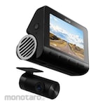
- 70Mai Kamera DasborDeskripsi:70mai Dash Cam A810 Set Front 4K 2160P Rear HDR 1080P GPS Night VisionMenetapkan Standar Baru untuk Kualitas Video :Didukung oleh sensor gambar Sony Starvis 2IMX678 terbaru, 4K A810 menghadirkan rekaman berkualitas sinematik yang merekam setiap detail di jalan dengan kejernihan tingkat berikutnya.Framerate tinggi 60FPS*/25FPS menghasilkan gambar yang lebih halus secara efektif untuk mencegah terjadinya hasil yang buram. Ini terutama membantu menangkap plat nomor dan rambu-rambu jalan selama mengemudi dengan kecepatan tinggi.Penglihatan Malam yang Luar Biasa :meningkatkan sensor, aperture besar, dan tambahan baru dari HDR, 4K A810 berjalan di atas dan di luar saat merekam di malam hari.Perekaman Belakang HDR yang Ditingkatkan :Dengan penambahan algoritma HDR, 70mai telah mengambil perekaman belakang selangkah lebih maju. Dibandingkan dengan kamera belakang sebelumnya, kamera belakang yang baru dikembangkan menonjol pada eliminasi noise. Saturasi warna dan keseimbangan eksposur. Bahkan dapat memilih detail gambar di malam hari dengan pencahayaan yang lebih kompleks, mengembalikan tampilan belakang keTingkat realitas maksimalAi Deteksi Gerakan:Dengan algoritma canggih yang menghitung jarak dan niat seseorang, A810 mengaktifkan perekaman ketika mengidentifikasi seseorang sebagai ancaman potensial.
- BASEUS Key Finer Wireless GPS TrackerDeskripsi:1. Mini dan CompactDesain sederhana dan mini, lindungi barang-barang Anda saat bepergian.2. Pengingat Dua ArahKetika jarak antara pengingat anti-kehilangan dan ponsel lebih besar dari pada koneksi koneksi [sekitar 30m di lingkungan terbuka dan 10m di lingkungan dalam ruangan]. alarm dua arah otomatis mengingatkan Anda.3. Satu-klik Pencarian CepatDalam jangkauan koneksi, buka aplikasi dan klik "Temukan", dan pengingat anti-kehilangan akan segera mengeluarkan suara untuk memudahkan pencarian.4. Panggilan Desibel tinggiAlgoritma audio yang dioptimalkan, volume yang ditingkatkan, temukan kembali barang anda tanpa kehilangannya.5. Query Trajectory cerdasDalam mode pemutusan, buka aplikasi untuk memeriksa posisi pemutusan terbaru sehingga item dapat dilacak.atribut:
- Color: White
- Material: PC
- Rated Power(uw): 10
- Product Size(mm): 37x25x6
- Rated Current (mA) : 3.3
- Rated Voltage (V): 3
- Volume (dB): 80-100
- Garmin GPSMAP H1atribut:
- Battery Life (hour): Up to 145 in GPS mode
- Battery Type: Rechargeable internal lithium-ion battery
- Dimensions (cm): 6.7x17.9x3.3
- Display Resolution (pixels): 282 x 470
- Display Type: Transflective color TFT
- Interface: USB-C
- Lens Material: Chemically strengthened glass
- Memory (GB): 64 (user space varies depending on included maps)
- Water Rating: IP67 (Water Resistance)
- FURUNO TransducerDeskripsi:White Line feature - Discriminate fish lying near the bottom- The top edge of the sea floor is displayed in white to clearly show structures.- This feature helps to discriminate bottom fish distinctly.Configurable Alarm function (depth, fish echoes, etc.)Post-processing Gain Control applied to all echoes displayed on the screenShare and display information on a chart plotter*Furuno's TLL (Target Lat/Lon) output allows you to interface the FCV-688 with your chart plotter so that you can mark fishing spots with various information (L/L, Depth, Water Temp, Fish size, Bottom).* Required connection to chart plotter.Fast transmission rate of 3,000 PRR (Pulse Repetition Rate) per minute (at 5 m depth range)ScreenshotsBottom Discrimination - Graphic modeBottom Discrimination - Probability modeACCU-FISH™ modeWhite Line functionFish Alarm functionatribut:
- Frequency (kHz): 50 and 200
-
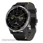
- Garmin Aviator Smartwatchatribut:
- Charging method: Garmin Proprietary Plug Charger
- Colour Display: Yes
-
- TRUSCO Resin Saddle BandDeskripsi:
Daftar Harga gps garmin 64s Terbaru June 2026
| Garmin GPSMAP 65s | Rp7.899.900 |
| Garmin GPS Genggam | Rp3.799.900 |
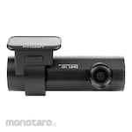
| Blackvue Kamera Dasbor | Rp3.199.900 |
| BOSCH Digital Laser Distance Meter (Meteran Laser) | Rp1.299.900 |
| Garmin GPS 73 | Rp3.699.900 |
| Transcend Portable Hard Drives StoreJet 25A3 | Rp2.399.900 |
| Garmin GPS Genggam | Rp10.999.900 |
| Garmin Handheld/Portable Aviation GPS | Rp19.999.900 |
| FURUNO GPS Navigator | Rp7.799.900 |
| Garmin Portable ADS-B Receiver | Rp20.999.900 |
Data diperbarui pada 03/06/2026 (Harga belum termasuk PPN)
